


TEB
| The TEB model is open-source and available on the website: http://redmine.cnrm-game-meteo.fr/projects/teb |
|---|
The Town Energy Balance (TEB), (Masson 2000) model has been developed to simulate the energy and water exchanges between the city and the atmosphere. It has been included in the SURFEX land-surface modelling system, that is itself coupled to Météo-France atmospheric systems MesoNH (research) and AROME (weather forecast). TEB has also been coupled to ARPS (to study convective impacts of Saint-Louis; Rozoff et al 2003) and RAMS.
TEB model processes
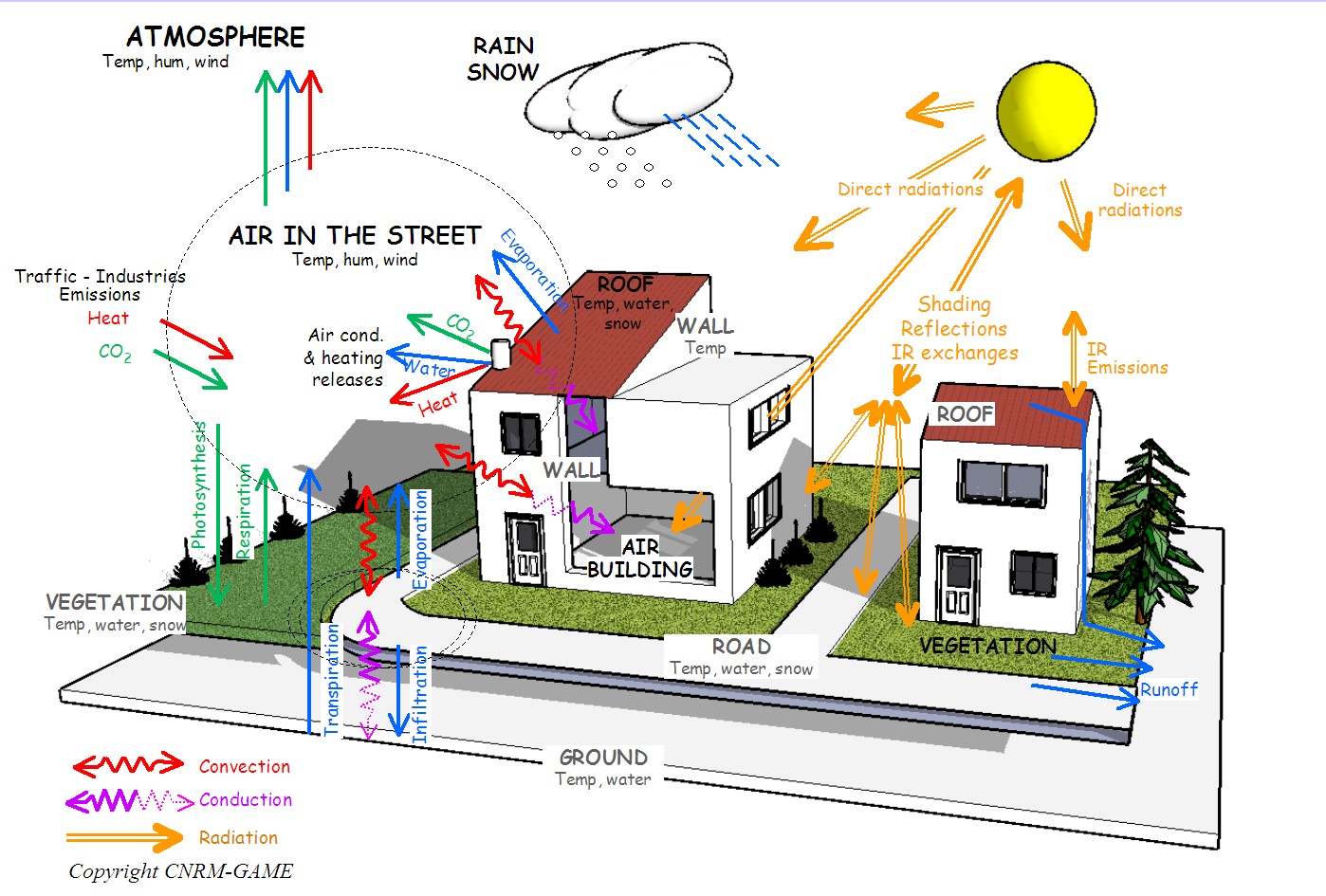
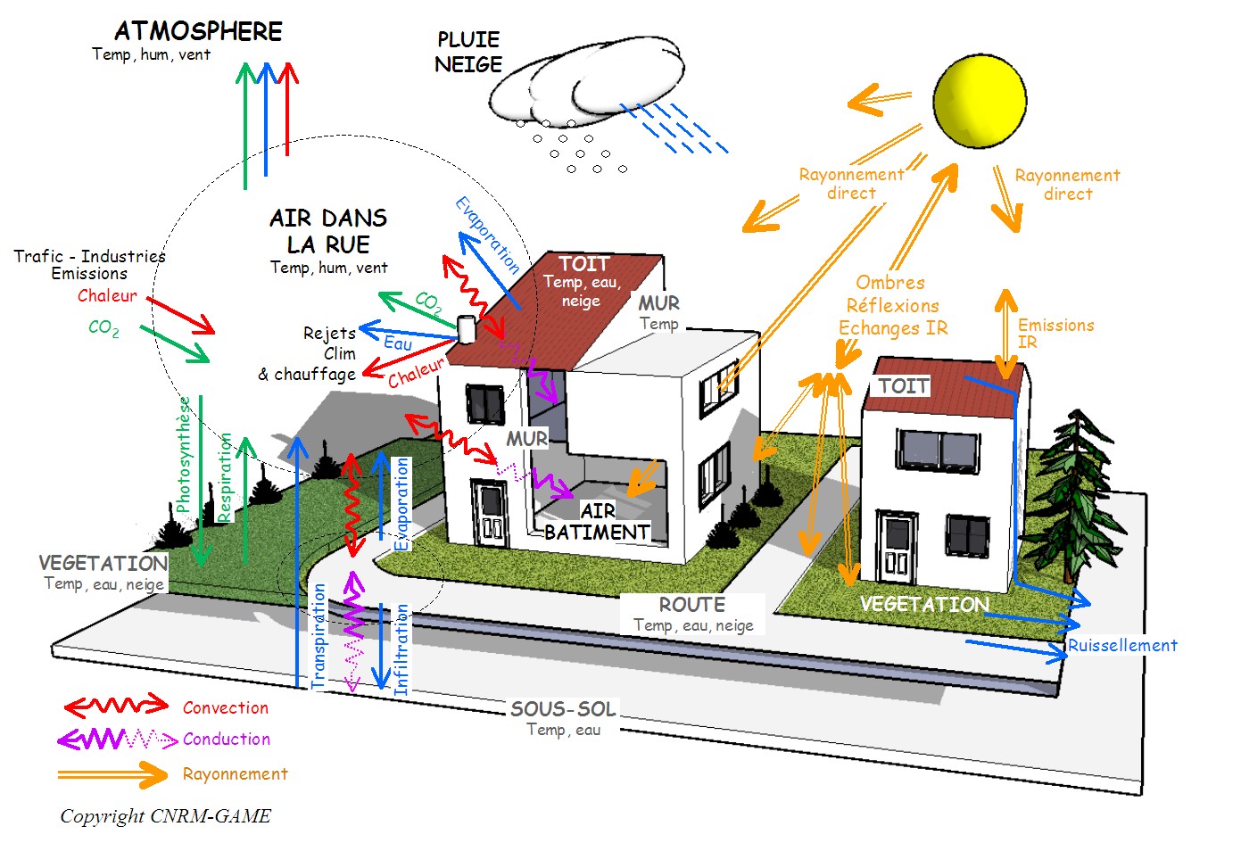
The most important processes that influence urban-atmosphere energy exchanges are take into account in TEB (see figure):
– 3D geometry of the city
– Radiative trapping, shadows
– Conduction in roofs, roads and walls separately (because they have very different materials)
– Water interception and evaporation, and also snow mantel evolution on roads and roofs (validated against Montreal data)
– Turbulent exchanges
Small-scale processes
The above processes are those important to simulate the energy fluxes towards the atmosphere. They were all taken into account into the first version of TEB. Actually, for impact studies, we need more small-scale details and processes :
– Shadows on vegetation and influence of gardens on street geometry
– Internal building energy balance and windows
– Domestic heating and air conditioning parameterization
– Human comfort index
TEB model concepts
The first advantage of TEB is to take into account a large range of physical processes, but with a parameterization conceptualization allowing fast computation time. For example:
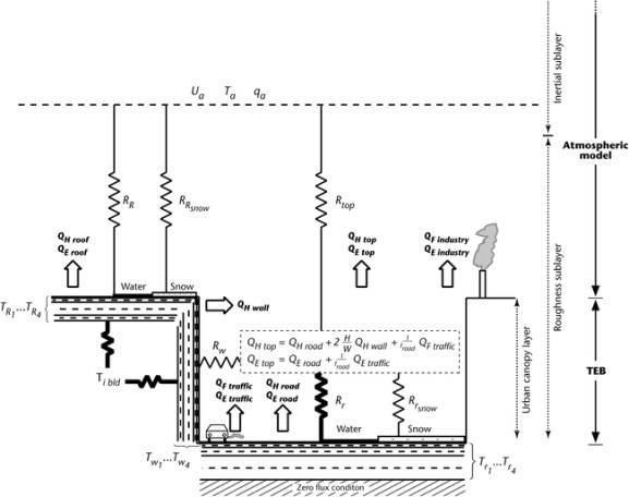
– The 3D shape of the city is not kept completely. TEB do not simulate individually each building (with its shape and material characteristics). TEB keeps the main feature driving radiative interactions and energy exchanges: an idealized 2D canyon geometry.
– In the same way, for energy balance computations, there is no need to simulate a lot of road and canyon directions. Only one computation is performed, with azimuthal averaged solar and wind forcing. For impact studies, computing several roads (e.g. for pedestrian comfort) we will use a version of the code with several street directions.
The air flows within the canyon is not simulated as in a CFD software (that have 3D or 2D atmospheric grids of 1m of resolution). We use either a resistance system or now an original 1D vertical turbulence scheme that simulate the mean characteristics of the flow in the canyon, skipping unnecessary (and computationally expensive) details.
|
|
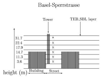
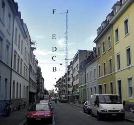
| Multi-layer version of TEB (Hamdi and Masson 2008) validated against BUBBLE experiment data (Rotach 2005) | |
TEB validation
The second advantage of TEB is, simply, that it has been validated against a very large number of instrumented urban sites around the world, that encompass various city structures and climates.
Modelling the urban climate
TEB, coupled to the MesoNH atmospheric model, allows to simulate finely and accurately the urban local impacts on the atmosphere. Just 2 examples:
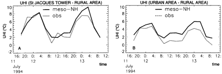
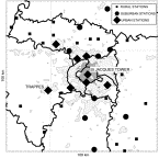
– PARIS urban heat Island
Our first urban heat island simulation study with TEB (Lemonsu et al 2002): on Paris, in summer, the UHI can be 2°C at day and as large as 8°C by night. This has been reproduced by the model very well.
|
|
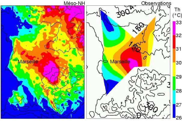
– Complex flows in a coastal city
On the city of Marseille, the complex shape of the shoreline as well as the presence of hills on 3 sides strongly influence the air flow and the see breeze impact (with southerly flows on the south side of the city, and North-Westerly flows on the North side). This impacts, as seen of the observations, a very complex temperature pattern, with warmest temperatures on the south of the city (not much urbanized), while on the West, near the “Vieux-Port “ (old harbour) dense old city core, the air is cooler. TEB and MesoNH simulate this!
Team(s) involved :
TURBAU