


Cartographie des paramètres de surface
Vegetation mapping
In order to spatialize the land surface models used in meteorology and in hydrology, CNRM has developed a global numerical land ecosystem database. This database is called ECOCLIMAP. It has a spatial resolution of 1km and is based to a large extent on satellite observations. Over Europe and the Mediterranean basin, ECOCLIMAP includes 273 landscape types. These categories result from the fusion of existing databases, CORINE-2000, covering EU countries only, with a spatial resolution of 100m, and GLC-2000, a global database. The fusion of CORINE-2000 and GLC-2000 produces a 76-class map. In order to refine the representation of some ecosystems/landscapes, time series of vegetation indexes derived from the SPOT/VEGETATION satellite data, from 1999 to 2005, are associated to the former classes. By using automatic classification techniques, 273 classes can be distinguished. Over France, the data base includes 168 classes.
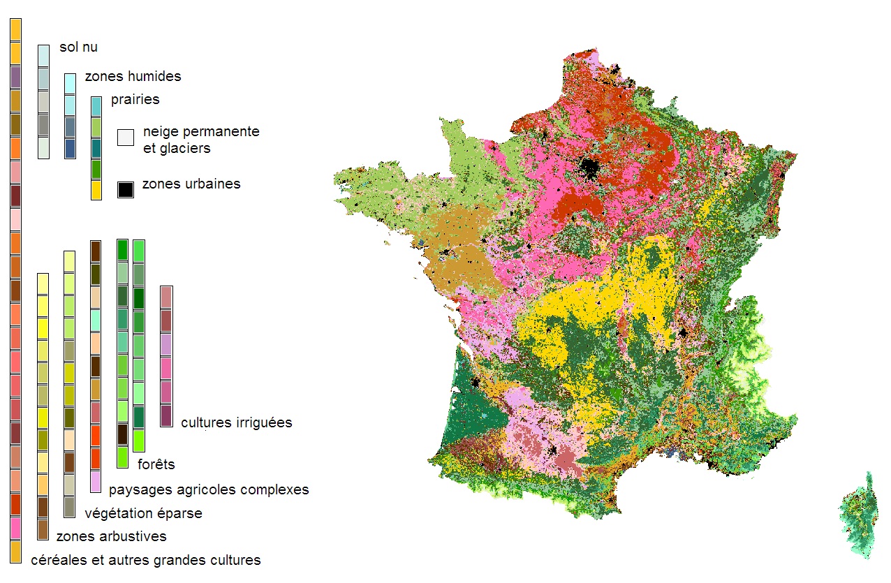
Landscape mapping over France (extracted from the ECOCLIMAP database).
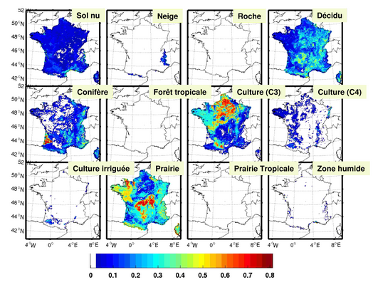
Fractions of surface types in France (extracted from the ECOCLIMAP database).